Alexander Davis
The Himalaya has rightly drawn global attention for the last few months, as India and China continue a troop build-up in Ladakh, particularly at Pangong Tso, Chushul and the Galwan Valley (Hutcheon et. al., 2020). In June of 2020, fighting between Chinese and Indian soldiers over disputed western Himalayan borders left 20 Indian soldiers dead, 20 seriously injured, and a still unconfirmed number of fatalities on the Chinese side (Dwivedi, 2020).[1] The tensions have been the worst the region has seen for several decades, with reports of ‘warning shots’ being fired in September 2020 (BBC, 2020). Negotiations between India and China have stalled. A likely result at this point appears to be the year-round militarisation of the India-China border in the Western Himalaya. This has already occurred on the nearby India-Pakistan border after the Kargil conflict of 1999 led to the perennial occupation of Siachen Glacier. The history of the militarisation of the Himalaya, and the strategy behind it, is relatively well understood, if not adequately critiqued, within IR scholarship.[2] The region, though, is far more than disputed lines on a map and the resultant military posturing. It is home to enormous cultural diversity, including hundreds of threatened languages. Its ice caps are the source of most of Asia’s large rivers, and play a key role in moderating the global climate. These cultures and environments are slowly being transformed by the geopolitical precarity.
Despite this, IR’s analysis of the region prioritises the interests of its states, rarely looking beyond the question of whether conflict or cooperation is likely (Davis et. al.,2020). As we ask this question, we often lose sight of the Himalaya’s environmental and cultural diversity, and a crucial international issue receives scant attention. Here, I argue that the statist framings offered by IR theory do allow us to interrogate the logic behind territorialising these borderlands or assist us in reckoning with the emergent environmental crisis. This is particularly disappointing because these changes are quite obviously international. Cultures, ecologies and geopolitics are all intimately connected in the Himalaya, in ways that our theories fail to explain or analyse, let alone critique. Indeed, I argue that the India, China and Pakistan tensions, and the mountains on which they take place, and the people who live next to them, are so poorly accounted for by mainstream IR theorising that it should call these frameworks into question in the first place.
Asking the Wrong Questions
By far the most commonly asked question asked by IR scholars when looking at the Himalaya is whether or not China, India and Pakistan will go to war with one another (Malone and Mukherjee, 2010; Raghavan, 2019; Karackattu, 2013; Joshi, 2011). This might, on first glance, seem sensible. The possibility of a war over borders between some of the world’s most populous states will always draw our attention. And yet, as I seek to demonstrate here, while this element of the story is indispensable, focusing solely on the movement of soldiers, and the construction of military infrastructure neglects the local effects of these developments, how the environment had constructed and continues to influence the state-level tensions, and how being territorialised by states has transformed the region. One rare exception to this is LHM Ling et al.’s (2017) collection India China, which emphasises that India and China are ‘civilisational twins,’ with various shared Himalayan inheritances. Although this presents a less state-centric approach, it ultimately does not quite capture the violence that the region’s major powers have wrought on the mountains in recent years.
Environmental History and Bordering the Region
We often talk about the ‘rise of Asia,’ or of India and China. The Himalaya is literally Asia rising. It rises each year by about five centimetres, as the Indian continental plate crashes into the Eurasian plate, as it has done for the past fifty million years. But it then loses some of this height through erosion, with the rocks grating against one another. This process produces sand and silt, which makes the rivers particularly fertile, enabling the population density we see today in the South, South East and East Asia (Gamble, 2019a). It also means that the mountains are unstable and prone to earthquakes (Gergan, 2016). As we will see below, the Himalaya are geologically young, and this feeds both the geopolitical and geological instability.
The borders in this region move as ice caps and rivers rise and recede with the seasons. Sometimes, the changes are less subtle. An 18th century treaty defined the Gandak River as the border between India and Nepal. But the river slowly shifted course, and the village of Susta found itself subjected to an international border dispute (Jamwal, 2017). The uncertainty over these borders is genuine. Within the British colonial ‘science’ of border-making (Goettlich, 2018), rivers, ice-caps and watersheds were seen as ideal borders. And yet, the mountains in Ladakh, the site of the current standoff, were not well surveyed before they became part of India, China and Pakistan. This, as Kyle Gardner (2019, 2020) has argued, is one of the reasons the current border disputes were left as blank spaces on the map.
During the colonial period, the Himalaya was governed as a patchwork of small polities and princely states, which were influenced by nearby, plains-based empires, without being ruled directly (Gamble, 2019a). The region’s terrain and altitude made it particularly difficult for lowland populations to exert their influence. This was very much the case in Ladakh, for example, which was influenced by its Dogra and British rulers, but they were only rarely physically present (Gardner, 2019). Efforts to survey the mountains were hindered by the altitude, terrain, and the lack of interest of local peoples. With decolonisation, Himalayan peoples experienced an increase of external authority over their lives, while much of the world found greater autonomy (Guyot-Réchard, 2016). China based its territorial claims on a sense of Tibetan ethnicity. Pakistan claimed all of South Asia’s Muslim majority territory, while India claimed to be home to all of South Asia’s religions. India and Pakistan fought over Kashmir and Ladakh (Varshney, 1991). The basis of claiming territory for these new states, then, was the culture, religion and ethnicity of local people. For sparsely populated ice caps, and even the diverse Himalayan foothills, this was not a helpful organising principle.
India and China, then, pushed forward to create a border. The newly formed People’s Republic of China annexed Tibet in 1949 and disputed India’s territorial claims in the Eastern and Western Himalaya. India based its claims on more generous readings of British cartography. Nepal and Bhutan were able to maintain their independence but have since had to manage difficult relationships between two sprawling plains-based states. Bordering regions at this altitude and along the watershed, however, was extremely imprecise (Gardner, 2019, 2020). It is also ultimately pointless. As we will see below, if we take into account the environmental and cultural costs of the project, the instinct to border these regions in the first place lies very much at the heart of the problem.
Competitive Infrastructure Projects and the Transformation of the Himalaya
With the challenge of bordering a region, India and China have slowly increased their presences in their borderlands through infrastructure projects. The 1962 India-China was partly sparked by China building a road across Aksai Chin on Indian-claimed territory. After the war, the Indian army reached the border near Tawang, a town in the Eastern Himalaya that had been occupied for a month. They found newly built Chinese roads and bridges. This was perhaps intended to impress the local population, as India had largely struggled to build such roads (Guyot-Réchard, 2016: 238).
Infrastructure technologies have improved substantially, and this is contributing to the cultural transformation of the region. It is also contributing directly to India-China tensions.
Until now, infrastructure development has been slow. One Indian engineer referred to the mountains as being full of ‘geological surprises’ (Gergan, 2019). When infrastructure is built in the region, it has often been slowed by unexpected water flowing out of the rocks whenever digging starts. One road, the Rohtang tunnel connecting Manali to Leh, has taken four decades but is expected to be completed this year (Dhillon and Chhina, 2020). This infrastructure boom has further facilitated the movement of troops and tourists. Chinese engineers, however, appear to have mastered building roads and high-speed rail networks across Western Tibet (Bhutia, 2016). This has fuelled Indian anxieties about China’s ability to deploy troops to contested regions like Ladakh. India is trying to catch up, by completing 61 strategic border roads in the region by 2022 (Singh, 2019).
Aside from road, rail and airports, Himalayan states have also come to see the region’s rivers as a source of ‘clean’ electricity through hydroelectric projects. This, though, comes with enormous risks in a geologically unstable region. Amelie Huber (2019) has argued that these dams place the costs of development on local populations. Dam construction has often been met with local protest, and when protests are ignored, social marginalisation increases (Gergan, 2020). China’s construction of dams on Himalayan rivers has also worried India about shared water resources (Gamble, 2019b). All of the Himalaya’s states are concerned about access to water resources and electricity generation. However, the rush to claim water resources leads these states to treat the watershed as something from which to extract resources. This makes environmentally sound governance, which looks after the health of the watershed, nearly impossible. The proximate cause of the recent fighting seems to have been infrastructure building on both sides. Building roads close to the border facilitates troop deployment, which provokes fear on the other side. The anxiety produces further infrastructure building.
The year-long militarisation of high-altitude regions is an extremely undesirable result not just for the environment, but also for the soldiers. Already, thousands of soldiers (Gao, 2016) have died in the Himalaya, not from fighting, but the extreme environmental conditions. Landslides and asphyxiation are common, particularly at year-round occupied high-altitude sites such as the India-Pakistan stand-off at Siachen Glacier. If India, China and Pakistan continue to see the watershed as a target for competitive resource extraction, this will only accelerate environmental degradation. The Himalayan environment will ultimately have the final say in this situation, as its ecology cannot sustain intense militarisation, climate change, and hydropower extraction over the long term.
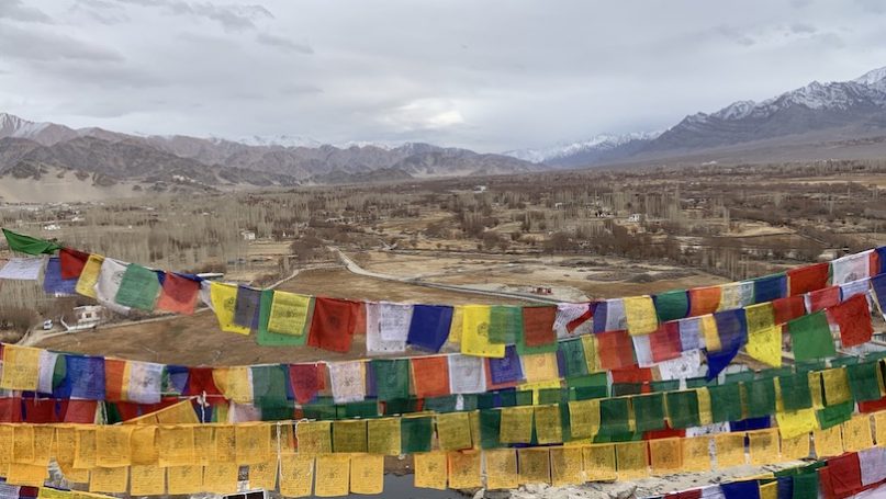
Cultural and Linguistic Transformations
Amidst this backdrop of competition, Himalayan cultures and languages are being transformed. This is accelerated by the increase in connectivity and the opening up of the region to the global economy. The Himalaya is one of many examples around the world of linguistic diversity rising with the terrain (Axelsen and Manrubia, 2014). In Bhutan, for example, there are twenty one indigenous languages recognised by the state, in a country of just one million people (Roche and Gawne, 2018). In one study of the Gerald Roche, Hiroyuki Suzuki and Chandra Jayasuriya (2018) found 48 minority languages outside of the Tibetan Autonomous Region (TAR). None of these languages receives support or recognition from the PRC. Rather, China lumps all of these languages together under the label ‘Tibetan’ and allows only education in this one standardised language.
This loss of languages is tragic. But it does not just happen by accident. It is the result of political and social structures that discourage linguistic diversity. Being boxed into states and folded into national identities has threatened the diversity in the Himalaya because languages are not neatly patterned to borders (Roche and Gawne, 2018). The success of state-backed languages such as Hindi, Dzongkha and Putonghua places further stress on Himalayan languages. This takes place alongside the global dominance of English as a language of business, a key element of this linguistic hierarchy.
The loss of languages also brings with it the loss of local ecological knowledge, which facilitates environmental destruction. Environmental destruction feeds more geopolitical tensions, as the state thinks it needs to get its hands on more water and hydropower resources.
Conclusion: Breaking IR Open
IR’s statist frameworks fail to comprehend the complexity of the Himalaya. If we try to analyse the region without taking into account the three key, interrelated factors of geopolitical tension, environmental destruction and cultural transformation, then we distort the reality the Himalaya’s difficulties. I write this particularly as many people who do this are self-identified ‘realists’. Himalayan geopolitics take place on shifting mountains, inhabited by minoritised peoples, many of whom speak endangered languages, whose postcolonial states behave like colonial governors as they fight over the borders drawn by their imperial forebears. This takes place against a backdrop of climate change and slowly melting ice, which is only accelerated by the geopolitical contest. These issues are all fundamentally international. They are geopolitical. Perhaps India and China’s policy elites are locked in a great power clash that is cleanly accounted for by a state-centric realism. And yet, IR’s failure to go beyond this part of the story ultimately facilitates a likely catastrophic ending.
There are some hopeful developments here, however. Green IR approaches have emphasised environmental agency in international affairs. Planet politics (Burke et. al, 2017) has suggested interdisciplinary engagements with environmental sciences. IR’s record on the contest to date though is largely focused on Delhi and Beijing, and not the mountains. IR is being left behind because its mainstream theoretical frameworks are unable to engage with these most pressing global challenges. Meanwhile, political geography (Gergan, 2020; Smith, 2013; McDuie-Ra and Chettri, 2019) and political ecology (Drew, 2017) have produced outstanding scholarship on the Himalaya which draws in the international context.
Folding the study of culture, history and ecology into IR’s frameworks, however, can add a great deal to our understanding of the international nature of this region. This might speak to future challenges elsewhere as well. To do this, though, requires genuine interdisciplinary engagement (Davis et. al., 2020). IR’s state as actor mode, though, still leads us to neglect the borderland peoples’ experiences of the conflict and misses the constitutive role that the dramatic Himalayan environment has played in producing the conflict. And so, thinking through the Himalaya should break IR open, and flood the discipline with knowledge from other sources that highlight the interconnection between environmental, political, and cultural transformations.
No comments:
Post a Comment