By Bérénice Guyot-Réchard and Kyle Gardner
Media reports of a violent clash between Indian and Chinese soldiers at the Naku Pass in north Sikkim on January 20 have raised the specter of an eastward shift in the nine-month border standoff between the nuclear-armed neighbors. A clash between soldiers at the Naku Pass last May preceded the deadliest and longest standoff between the two countries in decades. Much of the past year’s border tensions have centered on the shared border’s western end, in Ladakh, more than one thousand miles west of Sikkim. But these latest reports suggest that tensions may be returning to the eastern sections of the 3,488-kilometer long disputed border. The confrontation could get more unstable if it spreads even further east, in Arunachal Pradesh, where just last week satellite images surfaced showing a Chinese-built village within India’s boundaries.
China and India’s antagonism along the Himalayas is a centuries-old story. Both countries want a fixed boundary line in the Himalayas; yet the physical geography, cultural landscape, and political history of the world’s greatest mountain range has made any straightforward demarcation impossible.
Beginning in the 1840s, an array of British surveyors, generals, and administrators attempted to fix a border between India, Russia, and China’s still-expanding empires. These attempts were challenged by the topographical complexity of the massive Himalayas and the imperial insistence on the elegant “watershed principle” to guide their boundary line. Limited surveying compounded the complex geography and resulted in major segments of the would-be border remaining undefined at the time of independence in 1947.
What empires abandoned, would-be nation-states could not. Post-colonial India and Communist China could not abide the ambiguity of the “non-state” spaces accepted by their imperial predecessors. This means integrating their Himalayan periphery and asserting sovereignty over it.
While the two countries have been to war only once, in 1962, the undefined border has been a source of tension ever since. The recurring pattern of Sino-Indian tensions along the border risks assuming complacency. But this is more than a seasonal affective disorder afflicting the word’s two most populous countries. Things could get far more heated, and less controllable, if the confrontation spreads from its current focal point in Ladakh to the other major disputed area: Arunachal, which China claims as “South Tibet.”
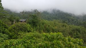
Arunachal, the size of Austria, lies on the other extremity of the Himalayas, east of Bhutan. Like Ladakh, its geography — a series of mountains that the mighty Tsangpo-Brahmaputra River barges through — has defied repeated attempts at boundary-making. Although colonial-era attempts at applying the watershed principle in the eastern Himalayas yielded greater success than in Ladakh, there was no single water-parting line surveyors could follow.
And there’s a key difference. In the west, China and India fight over an uninhabited desert. In the east, their struggle concerns an inhabited area of great cultural diversity and complex political history. The region is home to animists, Christians, Hindus, and Tibetan Buddhists. Tawang hosts the biggest Tibetan Buddhist monastery outside Chinese-held Tibet and is the birthplace of the sixth Dalai Lama.
In 1962, Arunachal was heavily fought over between Chinese and Indian troops. Beijing, victorious, eventually withdrew, preferring to entrench its control over the Aksai Chin — connecting the restive provinces of Xinjiang and Tibet — instead.
Fifty years ago, Aksai Chin mattered more to Beijing than Arunachal. Today, the situation is reversing. Having invested over decades to achieve infrastructural control over Tibet and the Aksai Chin, China likely views the western Himalayas as more secure and less essential. While India continues to claim the Aksai Chin, the object claimed is largely cartographic: the region has no precious resources, limited strategic benefits for India, and no permanent inhabitants.
By contrast, the eastern Himalayas are resource rich, strategically valuable, and inhabited by historically independent peoples. The eastern Himalayas’ powerful rivers form potential lifelines for these two energy-starved, water-scarce giants, leading to an intense competition for the exploitation of natural resources through dam-building. Meanwhile, the Dalai Lama’s advancing age means both countries worry about his succession. Controlling the Tibetan Buddhist Himalayas, notably Tawang, could potentially determine where the next Dalai Lama will be found.
Not only are the stakes higher in the east, but if tensions flare up, they could be harder to control. There, China and India aren’t just trying to control territory; they also competing for authority over Himalayan communities whose allegiance and cooperation cannot be taken for granted. If a military confrontation spreads in that region, the actions of local people may shape its course. And neither government will find it as easy to jettison inhabited territory as India did for the deserted Galwan Valley in eastern Ladakh.
Our attention is currently focused on the western and central Himalayas. We should remember to look east as well.
Bérénice Guyot-Réchard is Associate Professor in Contemporary International History at King’s College London. She is the author of “Shadow States: India, China and the Himalayas, 1810-62” (Cambridge University Press, 2017).
Kyle Gardner is currently a non-resident scholar at the Sigur Center for Asian Studies, George Washington University. His first book, “The Frontier Complex: Geopolitics and the Making of the India-China Border, 1846-1962,” has just been released with Cambridge University Press.
No comments:
Post a Comment