Even from outer space, Fenway Park is immediately recognizable. That “lyric little bandbox of a ballpark,” as John Updike famously described it in 1960. “Everything is painted green and seems in curiously sharp focus, like the inside of an old-fashioned peeping-type Easter egg.”
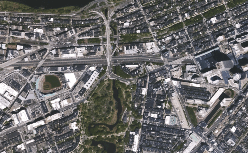 At the time, space programs like Gemini and Apollo hadn’t yet launched. Neil Armstrong was still nearly a decade from setting foot on the moon. It’s unlikely, then, that Updike could have imagined Fenway the way we can see it today—in high definition, but from a great distance. A mossy looking diamond, still in curiously sharp focus in its own way. Here’s footage from UrtheCast’s ultra high-definition camera aboard the International Space Station:
You can see the cars on Storrow Drive! (And even more clearly on I-90.) You can see the Prudential Center and the Hancock Building appear to drift, leaning into their shadows as the camera vantage point changes in relation to the ground.
The whole thing is astonishing, sure, but it’s strange in a darker way, too. UrtheCast offers surveillance data as a service so that businesses can “monitor areas of interest with consistent access to satellite imagery in order to analyze, strategize, and plan,” according to its website. The famous example in the satellite business is the idea that companies will be able to count the cars in their parking lots to track customer flow, estimate revenue, and otherwise contextualize their work.
And yet.
“Am I the only person here who finds the idea of privately-owned cameras in space continuously filming the surface of the planet deeply, deeply, deeply creepy?” one person wrote in a Vimeo comment on the UrtheCast video. “I'm amazed to see so much preoccupation with the technical side of the filming and zero engagement with the very worrying implications this has for privacy and abuse. How is this even remotely okay?”
The Defense Department already uses high-definition satellite imagery to track what’s going on in the United States—tools once restricted to foreign intelligence gathering have, for nearly a decade, been authorized for domestic use. And corporate interests aren’t far behind. (In fact, companies like Digital Globe arearguably leading the way: Its satellite imagery is used both by the U.S. military and Google's mapping operation.)
“Impressive stuff,” another Vimeo commenter wrote of UrtheCast’s latest offerings. “Only a matter of time before Google Earth is live.”
UrtheCast also posted videos of London:
No comments:
Post a Comment