


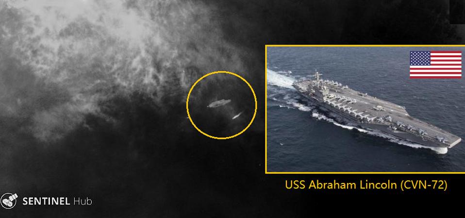
 We recently showed how open-source intelligence analysts using freely available commercial satellite imagery can pinpoint a Chinese aircraft carrier hundred of miles out to sea. It wasn’t easy, but it worked. This applies to U.S. navy aircraft carriers also, but it is not always straightforward.
Back in the 1950s when the U.S. Navy conceived its super-carriers, commercial imaging satellites did not exist. Once out to sea, only sophisticated adversaries could track the ship’s location. But today commercial satellite imagery has become commonplace, and at least in some cases they can find a carrier at sea.
Using this, a small country or non-state actor (or even a journalist!), can try to keep tabs on warships. In a crisis situation this intelligence could be detrimental to the Navy. It’s a radically different situation from when U.S. carriers deployed for Operation Desert Storm in 1991, or the Balkans in 1995.
The first high resolution satellite, IKONOS, was only launched 20 years ago. Since then there has been an explosion of satellites, and the pace is increasing. According to Itay Bar-Lev, co-founder of Shadowbreak Intl an intelligence consultancy, recent developments in cube satellites and constellations of nano satellites have massively increased the number of images available. We are already approaching real-time optical monitoring. It is costing providers less to develop and launch the satellites, so Bar-Lev believes that the trend will continue.

World map showing one-day coverage (red) of world oceans using Sentinel Hub's satellites. This is ... [+] H I SUTTON, DATA FROM SENTINEL HUB
So will it get even easier to find an aircraft carrier in the vast expanse of the ocean? In short, yes. But the first thing to be aware of is that commercial satellites are mostly focused on the land. They do not image vast tracts of ocean unless there’s a need.
Technically however there is no spot on the globe that is not covered. Satellite imagery providers have their own priorities and strategic clients, but if you are able to pay then the images are possible. Science and environment focused satellites tend to cover more ocean. Often these are not high resolution, but still good enough to find an aircraft carrier.
The weather is another challenge for traditional optical sensors. But it can be solved by synthetic-aperture radar (SAR). Today most SAR images are low resolution, enough to find a carrier but not much more. But providers are launching much higher resolution SAR satellites which can see through clouds. They can even see in the dark.
Samuel Cardillo, another co-founder at Shadowbreak Intl, says that new providers are appearing fast. They offer different pricing, resolution, coverage and agility. And the main providers are sending new constellations into orbit this year. So Cardillo expects the next five years to be a game changer when it comes to accessibility to new imagery.
So if a carrier dashes out into the Pacific, it is still very difficult for amateurs to find. This potentially gives the U.S. Navy an advantage as often its carriers are in the open ocean. But carriers do not spend all their time hiding there. Many potential mission areas such as the South China Sea, Mediterranean, or Persian Gulf place the carrier within easy reach. And if carriers have to hide far out in the ocean just to get away from commercial satellites it will reduce the effective reach of their aircraft.
The oceans are vast, but a determined adversary with paid commercial imagery may already be able to intermittently track a carrier anywhere on earth. And the nearer it comes to land, the higher the risks.
No comments:
Post a Comment