


KRIS OSBORN

Delivering time-sensitive, life-saving supplies from low altitudes during a major humanitarian crisis, helping police track criminals on the run and even quickly dropping-off pizza from just a few miles away in an uneven urban environment … are all things drones will do in the very near future.
Deconflicted Lower Altitude Drones
Much of the technology for these kinds of key civilian tasks, enabled by advanced computer algorithms, automation and radio-frequency transmission, is here today to a certain degree. However, airspace for lower altitude drones must be “deconflicted” to ensure safety and new computer technology needs to enable “Beyond Visual Line of Sight” operation for commercial drones.
Given the pace of the market’s current expansion of smaller unmanned systems increasingly capable of performing a wider range of tasks, and the value-added promise that they bring, the FAA is working intensely with commercial and defense companies like Raytheon Intelligence & Space to reach breakthrough levels of secure, deconflicted beyond visual line-of-sight drone flight.
“Unmanned traffic management capability deals with the future. This is a new megatrend for electrically powered vehicles, whether they're small drones, that are delivering packages from Amazon or UPS, or large passenger carrying, or cargo carrying aircraft that are electrically powered.
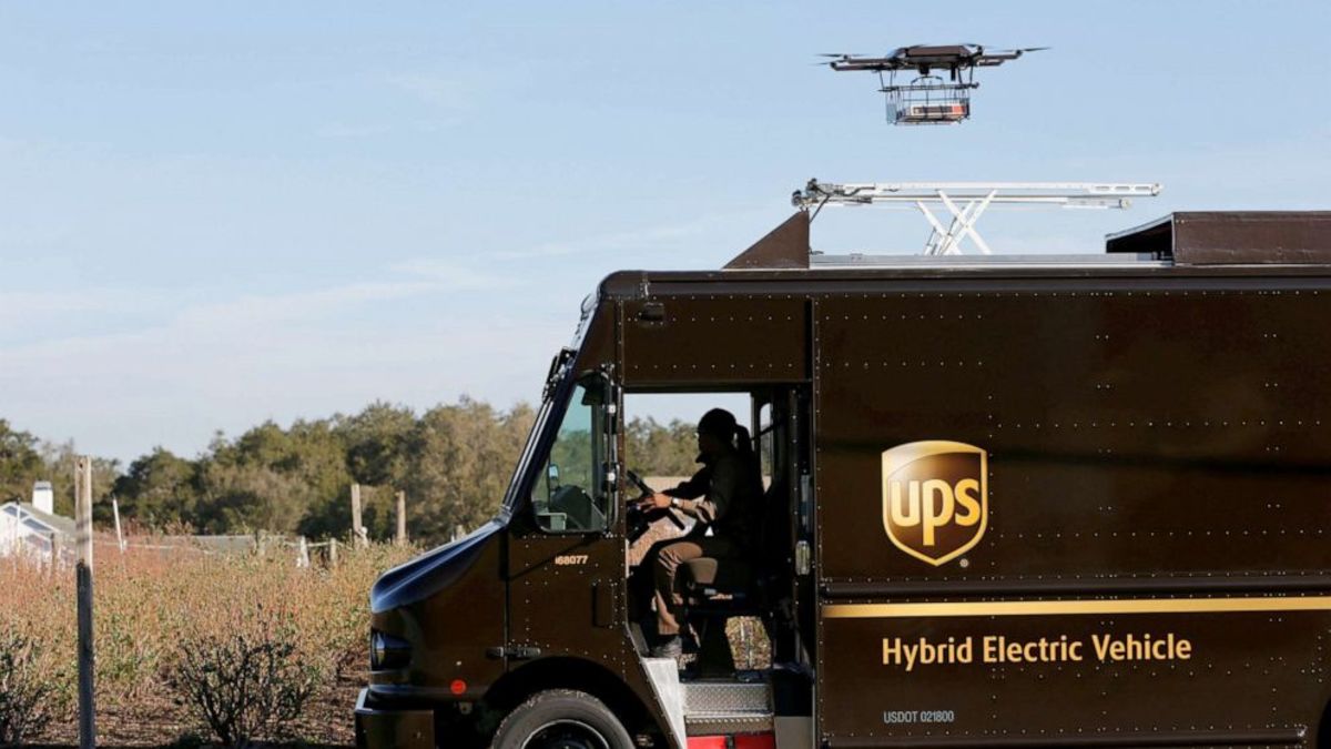
A drone demonstrates delivery capabilities from the top of a UPS truck during testing in Lithia, Florida, Feb. 20, 2017.
They're all going to be flying relatively low level, from the surface to maybe 400 feet for the small package delivery drones. It will likely be surface to five or 10,000 feet for passenger carrying drones,” Kip Spurio, Technical Director of Air Traffic Systems at Raytheon Intelligence & Space, told Warrior in an interview.
The ability to navigate and fly “beyond visual line of sight” is what Spurio referred to as the “holy grail” of future civilian small drone flight. At the moment, Spurio explained, low altitude commercial drones must maintain a “line-of-sight” connectivity at all points during its flight path, meaning operators would need to either travel close to the drone or position others to pick up and “track” an extended flight.
“We're working with a couple of delivery operators, working towards dealing with the FAA and gaining beyond visual line of sight approval. That is the holy grail for this whole economic structure to work,” Spurio said.
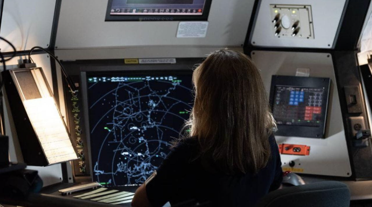
Active Electronically Scanned Array Radar
Using cutting-edge Active Electronically Scanned Array Radar technology, cloud computing and advanced automation, RI&S has engineered a new “end-to-end” system designed to enable deconflicted, secure, beyond visual line-of-sight low altitude drone flight. Technically, the effort involves integrating aviation-grade automation platforms and detect and avoid capability to enable high-volumes of low-altitude surveillance and cloud-enabled computer data storage and analysis able to merge, organize, analyze and distribute critical detail as needed to drone operators.
An AI-enabled system, for instance, could gather massive streams or pools of data from disparate sources, bounce them off a vast-database to organize information, perform analytics and offer solutions from among otherwise separate sensors and data collection technologies. AI-can also analyze variables such as weather, navigation or sensor fidelity and range in relation to one another to offer optimal “recommendations” to human controllers.
“We are working on enabling the infrastructure that allows uncrewed systems to fly beyond the visual line of sight, on demand. That would include a surveillance capability and the ability to provide value-added information related to things like the status of the airspace, weather, current visibility, winds or a need to track a vehicle,” Spurio explained.
Technical elements from some of RI&S’s existing Air Traffic Control Systems are informing the maturation of this new end-to-end system. One of these is a technology called Multi-platform Application Re-hosting Solution, known as MARS. MARS organizes disparate pools of data and sensor information into a single screen for operators to ease the cognitive burden, increase decision-making efficiency and consolidate otherwise separate streams of information.
Standard Terminal Automation Replacement System (STARS)
Standard Terminal Automation Replacement System (STARS) is another RI&S system, now used across Air Traffic Control Systems to provide sequencing guidance for arriving and departing aircraft. Part of the modernization effort for STARS aligns with what Spurio discusses regarding the new end-to-end system because it’s oriented toward building upon an established hardware and software baseline.
Part of the concept is to upgrade and modernize integrated software without having to fully re-architect a hardware system by aligning technical standards and IP protocol. An interesting FAA research paper as far back as 1997 seems to anticipate the growing role of software in the realm of Air Traffic Management (ATM). The FAA Paper, called “Technology Evolution and its Impact upon Air Traffic Management,” seems to have foreshadowed current modernization technical approaches many years ago, writing “In the computer hardware and software area, in communications, and even in navigation, we represent a very small segment of the market and, in most cases, the capability of the technologies in these areas are more than adequate for Air Traffic Management needs,” (Andrea Zellweger).
The concept or future vision for unmanned systems now being pursued by RI&S and the FAA to create new standards, seems to represent what could be called the evolution or maturation of the kinds of “open architecture” approaches to software upgrades and common standards anticipated years ago. All of this lead to the emergence of a technological system enabling a circumstance wherein multiple drones and unmanned systems of all shapes and sizes can perform a wide range of key functions at specific altitudes and speeds at a certain time to “deconflict” with one another in a high-speed, coordinated and accurate way.
“There is a lot that goes into the communications possibilities. There is a lot of cyber protection to make sure that the information that they are using is secure and has a high level of integrity,” Spurio said.
Cloud computing, Spurio explained, can integrate large pools of otherwise disparate sets of information and make data available, as needed, to drones flying a specified route at a certain time and a certain altitude such that it is fully deconflicted with other drones.
The intent of RI&S’s cloud-enabled end-to-end system is to enable drones to “transit the airspace with all the capabilities we're going to provide, allowing them to operate beyond visual line of sight, unobstructed,” Spurio described.
“We're taking certain capabilities and wrapping them in containers and putting them in the cloud or developing other ones from scratch. And we're doing all this to show the FAA that this can be done, you know, rapidly and, safely and securely,” Spurio said.
Much of RI&S’s system involves software engineering and upgrades, analyzed in large measure through advanced modeling and simulation. The fundamental task essentially pertains to data flow, data management, data analysis and data transmission in an organized, de-conflicted pattern to enable autonomous navigation and safe, unobstructed flight.
“We've created a modeling and simulation environment to develop this, using tools that we at Raytheon have in place. We've created a simulation model for our capability,” Spurio added.
The emerging technologies, if applied effectively, can help create new technical standards, interfaces and software applications such that large amounts of lower-altitude drones can operate successfully in what might otherwise be unsafe, congested environments.
“It is a process that is not well defined with the FAA right now. We are working with our various teammates to jump through hoops as the FAA learns how they want to do this. They don’t have long-established standards for how to do it yet,” Spurio said.
No comments:
Post a Comment