http://www.defenseone.com/technology/2016/10/echoes-future-war-how-fight-mosul-will-change-ied-science/132648/?oref=d_brief_nl
By Patrick Tucker
October 25, 2016
Reseachers are using seismic sensors to learn about enemy weapons — and one day, even to find them as they fire.
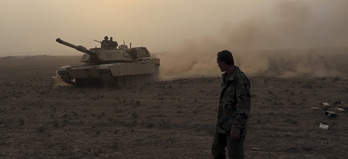
When a roadside bomb took the life of the first U.S. servicemember to die in the drive on Mosul, the shock waves were picked up by seismic sensors. Researcher Gassan Aleqabi was in nearby Sulaymaniyah, maintaining the local node of the Northern Iraq Seismic Network, or NISN, in the hopes that the data it gathers will one day help protect troops from IEDs and similar explosive weapons.
History credits 19th-century geologist John Milne with the creation of the first modern seismograph, a tool to measure tremors in the earth. In 1960, the U.S. military established the World Wide Standard Seismographic Network, putting the devices to work monitoring Soviet nuclear tests. Today, Aleqabi and his fellow researchers are exploring what seismographs and acoustic sensors can tell us about IEDs.
in 2006, enemy mortar rounds struck a munitions dump on Camp Falcon, a forward operating base just outside of Baghdad, setting off a lengthy chain reaction of explosions. Energy from the blasts moved through the air at supersonic speeds, and through the earth as seismic waves, where they were detected and measured by the nearby Baghdad Seismic Observatory. Aleqabi, along with Michael Wysession, professor of earth and planetary sciences at Washington University in St. Louis and other researchers, discovered a unique sound picture of what had occurred. They published their paper on the subject at the end of 2015.
“We just happened to be four miles away from the Air Force ammo post that got hit by mortar fire and underwent this cookoff over a period of a day. And we looked back through records and realize we were close enough to record car bombs and we could pick out helicopter signals … drones and variety of other military operations,” Wysession said. The researchers found that they could discriminate sources by their sounds, and subsequently set up the NISN to further explore the concept.
Today, the NISN consists of 10 stations, eight of them active. They contain STS-2 seismometers, Q330 data-loggers that digitize and broadcast seismic information, and GPS receivers for position and timing. There’s also a Kurdistan-Iraq research station, or KSIRS, that collects data from an seismo-acoustic array of five seismographs set 500 meters apart.
The U.S. military has been littering battlefields with unattended ground sensors since the Vietnam War. Today there are more than 1,500 unattended ground sensors in Afghanistan, alone. The Army is looking to field a new software system called the Integrated Sensor Architecture in 2019. The architecture will enable analysts, base security guards, or anybody to receive and share ground sensor data instantly.
The military is also innovating the sensors themselves. In 2015, the Defense Advanced Research Projects Agency, or DARPA, announced a program called Near Zero Power RF and Sensor Operations, or N-ZERO, program, seeks designs for sensors that draw just 10 nanowatts of power,about as much as a wristwatch, allowing the sensors to stay in operation for years without interruption.
Seismic gear can’t predict blasts, but the data can reveal information about an enemy’s arsenal. And in the future, they might be able to track down the source of mortar rounds.
With a large enough array of seismographic sensors, Wysession believes that they could have figured out the origin of the mortar attack.
Don't Miss
 The Worst Is Yet To Come in Mosul, US Leaders Say
 Someone Weaponized the Internet of Things
 GM Has Built A Stealth Truck for the Army
 Trump vs. the Generals
 Weapons of the Syrian War: Timeline and Overview
Advertisement
“If we had had real-time analysis of a network of a handful of stations there, you could have instantly seen where the mortar fire was coming from and intercepted it. And maybe that destruction of the air force ammo base could have been prevented,” he said of Camp Falcon.
That shows a big disconnect between today’s military capabilities and tomorrow’s needs. The Pentagon of 2016 excels at taking pictures of people in deserts and hills, where satellites, spy planes, or drones have an unobstructed view. But war increasingly takes place in crowded urban environments that defy easy image collection from above.
“We now have shifted to this sort of urban, guerilla-style warfare,” Wysession said. “You can’t always see what’s going on. And so if you have someone who is firing off a mortar at night, that’s really hard to pick up visually. But if you had a network of seismometers, you could pinpoint it exactly.”.
Cities across the United States already use a similar system called ShotSpotter, which uses acoustic data to pinpoint the location of gunfire.
The application of seismographic data to warfare is an emerging science, too young to save the life of Navy Chief Petty Officer Jason C. Finan. But the data that Aleqabi and his fellow researchers are collecting in Iraq today could help soldiers in future wars prepare for what they can’t see over the horizon.
Patrick Tucker is technology editor for Defense One. He’s also the author of The Naked Future: What Happens in a World That Anticipates Your Every Move? (Current, 2014). Previously, Tucker was deputy editor for The Futurist for nine years. Tucker has written about emerging technology in Slate,
By Patrick Tucker
October 25, 2016
Reseachers are using seismic sensors to learn about enemy weapons — and one day, even to find them as they fire.
When a roadside bomb took the life of the first U.S. servicemember to die in the drive on Mosul, the shock waves were picked up by seismic sensors. Researcher Gassan Aleqabi was in nearby Sulaymaniyah, maintaining the local node of the Northern Iraq Seismic Network, or NISN, in the hopes that the data it gathers will one day help protect troops from IEDs and similar explosive weapons.
History credits 19th-century geologist John Milne with the creation of the first modern seismograph, a tool to measure tremors in the earth. In 1960, the U.S. military established the World Wide Standard Seismographic Network, putting the devices to work monitoring Soviet nuclear tests. Today, Aleqabi and his fellow researchers are exploring what seismographs and acoustic sensors can tell us about IEDs.
in 2006, enemy mortar rounds struck a munitions dump on Camp Falcon, a forward operating base just outside of Baghdad, setting off a lengthy chain reaction of explosions. Energy from the blasts moved through the air at supersonic speeds, and through the earth as seismic waves, where they were detected and measured by the nearby Baghdad Seismic Observatory. Aleqabi, along with Michael Wysession, professor of earth and planetary sciences at Washington University in St. Louis and other researchers, discovered a unique sound picture of what had occurred. They published their paper on the subject at the end of 2015.
“We just happened to be four miles away from the Air Force ammo post that got hit by mortar fire and underwent this cookoff over a period of a day. And we looked back through records and realize we were close enough to record car bombs and we could pick out helicopter signals … drones and variety of other military operations,” Wysession said. The researchers found that they could discriminate sources by their sounds, and subsequently set up the NISN to further explore the concept.
Today, the NISN consists of 10 stations, eight of them active. They contain STS-2 seismometers, Q330 data-loggers that digitize and broadcast seismic information, and GPS receivers for position and timing. There’s also a Kurdistan-Iraq research station, or KSIRS, that collects data from an seismo-acoustic array of five seismographs set 500 meters apart.
The U.S. military has been littering battlefields with unattended ground sensors since the Vietnam War. Today there are more than 1,500 unattended ground sensors in Afghanistan, alone. The Army is looking to field a new software system called the Integrated Sensor Architecture in 2019. The architecture will enable analysts, base security guards, or anybody to receive and share ground sensor data instantly.
The military is also innovating the sensors themselves. In 2015, the Defense Advanced Research Projects Agency, or DARPA, announced a program called Near Zero Power RF and Sensor Operations, or N-ZERO, program, seeks designs for sensors that draw just 10 nanowatts of power,about as much as a wristwatch, allowing the sensors to stay in operation for years without interruption.
Seismic gear can’t predict blasts, but the data can reveal information about an enemy’s arsenal. And in the future, they might be able to track down the source of mortar rounds.
With a large enough array of seismographic sensors, Wysession believes that they could have figured out the origin of the mortar attack.
Don't Miss
The Worst Is Yet To Come in Mosul, US Leaders Say Someone Weaponized the Internet of Things GM Has Built A Stealth Truck for the Army Trump vs. the Generals Weapons of the Syrian War: Timeline and Overview Advertisement
“If we had had real-time analysis of a network of a handful of stations there, you could have instantly seen where the mortar fire was coming from and intercepted it. And maybe that destruction of the air force ammo base could have been prevented,” he said of Camp Falcon.
That shows a big disconnect between today’s military capabilities and tomorrow’s needs. The Pentagon of 2016 excels at taking pictures of people in deserts and hills, where satellites, spy planes, or drones have an unobstructed view. But war increasingly takes place in crowded urban environments that defy easy image collection from above.
“We now have shifted to this sort of urban, guerilla-style warfare,” Wysession said. “You can’t always see what’s going on. And so if you have someone who is firing off a mortar at night, that’s really hard to pick up visually. But if you had a network of seismometers, you could pinpoint it exactly.”.
Cities across the United States already use a similar system called ShotSpotter, which uses acoustic data to pinpoint the location of gunfire.
The application of seismographic data to warfare is an emerging science, too young to save the life of Navy Chief Petty Officer Jason C. Finan. But the data that Aleqabi and his fellow researchers are collecting in Iraq today could help soldiers in future wars prepare for what they can’t see over the horizon.
Patrick Tucker is technology editor for Defense One. He’s also the author of The Naked Future: What Happens in a World That Anticipates Your Every Move? (Current, 2014). Previously, Tucker was deputy editor for The Futurist for nine years. Tucker has written about emerging technology in Slate,
No comments:
Post a Comment